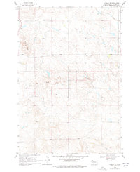
1968 Map of Ludlow SE
USGS Topo · Published 1977About this map
Ashcroft Butte and Flint Butte anchor this high-plains landscape in Harding County, where early-century ranching and sparse rural infrastructure remained the norm through the 1960s. The drainage patterns of Big Nasty Creek, Horse Creek, and Lems Creek define the movement across this open country, carving through the terrain near the North Dakota border. Evidence of local industry and education appears in the northeast and northwest corners, where the Lanesboro Sch served the surrounding families and a solitary Mine suggests the area's mineral prospects. This survey captures a moment before modern consolidation, preserving the locations of namesake landforms and small-scale creek systems like Coal Bank Creek and Spring Creek that were vital to the livestock operations of the northern South Dakota prairie.
Find a feature on this map
11 named features on this map. Tap any name to fly to it.
Don’t see what you’re looking for? This feature index may not catch every label — zoom into the map to look around manually.
Map Details
Editions of this 1968 Ludlow SE Map
2 editions found
Other maps of this area

1935 · Reva
USGS Topo · 1:125,000

1954 · Lemmon
USGS Topo · 1:250,000

1957 · Lemmon
USGS Topo · 1:250,000

1968 · Eagles Nest Butte
USGS Topo · 1:24,000

1968 · Ralph SW
USGS Topo · 1:24,000

1968 · Bowman-Haley Dam
USGS Topo · 1:24,000

1968 · Ludlow
USGS Topo · 1:24,000

1968 · Tepee Buttes
USGS Topo · 1:24,000

1968 · Ludlow SE
USGS Topo · 1:24,000

1969 · Reva NW
USGS Topo · 1:24,000