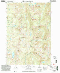
2004 Map of Box Lake
USGS Topo · Published 2007About this map
High alpine basins and towering summits define this section of the Payette National Forest, as documented in a 2004 revision of earlier 1960s topographic data. The landscape is dominated by the granite heights of South Loon Mtn and Beaverdam Peak, which provide the backdrop for a dense concentration of glacial tarns including Box Lake, Twentymile Lakes, and the Sisters Lakes. The drainage patterns are clearly defined by the headwaters of Lick Creek and Pearl Creek, revealing the natural corridors used for navigation through these heights.
Find a feature on this map
40 named features on this map. Tap any name to fly to it.
Don’t see what you’re looking for? This feature index may not catch every label — zoom into the map to look around manually.
Map Details
Editions of this 2004 Box Lake Map
This is the sole edition of this map. No revisions or reprints were ever made.
Other maps of this area

1911 · Meadows
USGS Topo · 1:125,000

1938 · Riggins
USGS Topo · 1:96,000

1945 · Riggins
USGS Topo · 1:125,000

1955 · Baker
USGS Topo · 1:250,000

1955 · Grangeville
USGS Topo · 1:250,000

1956 · Elk City
USGS Topo · 1:250,000

1957 · Challis
USGS Topo · 1:250,000

1959 · Baker
USGS Topo · 1:250,000

1959 · Grangeville
USGS Topo · 1:250,000

1960 · Elk City
USGS Topo · 1:250,000