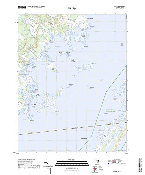
2023 Map of Boxiron
USGS Topo · Published 2023About this map
Boxiron sits at the edge of a complex network of coastal wetlands and tidal inlets along the eastern shore of Maryland. This landscape is defined by its relationship with the water, where small settlements like Figgs Landing and George Island Landing provided essential access to Chincoteague Bay. The interior is marked by numerous family-named landmarks and water bodies, such as Purnell Pond, Colburns Gut, and Duerrs Neck, reflecting a long history of local land use.
Find a feature on this map
96 named features on this map. Tap any name to fly to it.
Don’t see what you’re looking for? This feature index may not catch every label — zoom into the map to look around manually.
Map Details
Editions of this 2023 Boxiron Map
This is the sole edition of this map. No revisions or reprints were ever made.
Other maps of this area

1901 · Snow Hill
USGS Topo · 1:62,500

1901 · Green Run
USGS Topo · 1:62,500

1938 · Green Run
USGS Topo · 1:62,500

1942 · Chincoteague East
USGS Topo · 1:24,000

1942 · Snow Hill
USGS Topo · 1:24,000

1942 · Tingles Island
USGS Topo · 1:24,000

1942 · Wesley
USGS Topo · 1:24,000

1943 · Snow Hill
USGS Topo · 1:31,680

1943 · Boxiron
USGS Topo · 1:31,680

1943 · Whittington Point
USGS Topo · 1:31,680