
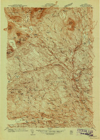
1933 Map of Boyd Lake
USGS Topo · Published 1933About this map
The Piscataquis River and the Bangor and Aroostook railroad corridor define this rural Maine landscape in the early 1930s. The region is characterized by a dense network of small local schools, such as Hoxie Sch and School No 5, indicating a distributed agricultural population. Significant wetland areas like Freese Bog and Sargent Bog separate the upland settlements of Bradford and Lagrange.
Find a feature on this map
72 named features on this map. Tap any name to fly to it.
Don’t see what you’re looking for? This feature index may not catch every label — zoom into the map to look around manually.
Map Details
Editions of this 1933 Boyd Lake Map
This is the sole edition of this map. No revisions or reprints were ever made.
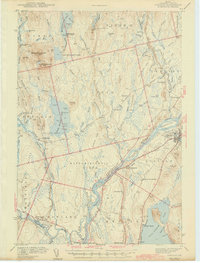
Other maps of this area

1902 · Orono
USGS Topo · 1:62,500

1902 · Bangor
USGS Topo · 1:62,500

1917 · Passadumkeag
USGS Topo · 1:62,500

1931 · Stetson
USGS Topo · 1:48,000

1932 · Dover-Foxcroft
USGS Topo · 1:48,000

1935 · Dover-Foxcroft
USGS Topo · 1:62,500

1935 · Stetson
USGS Topo · 1:62,500
1940 · Sebec
USGS Topo · 1:48,000
1942 · Lincoln
USGS Topo · 1:62,500

1942 · Bangor
USGS Topo · 1:62,500