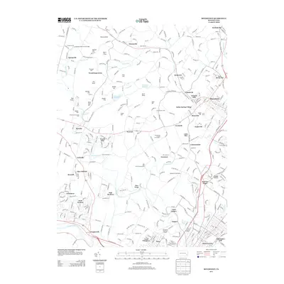
2013 Map of Boyertown
USGS Topo · Published 2013About this map
Manatawny Cr and Ironstone Cr carve through this corner of Montgomery and Berks counties, where early industrial sites like Griesemers Mill and the Griesemers Mill Covered Bridge reflect a deep heritage of milling. The landscape is defined by its transition from the steep ridges of Pinnacle Point and Shenkel Hill in the north to the broader river valley of the Schuylkill River at the southern margin.
Find a feature on this map
76 named features on this map. Tap any name to fly to it.
Don’t see what you’re looking for? This feature index may not catch every label — zoom into the map to look around manually.
Map Details
Editions of this 2013 Boyertown Map
This is the sole edition of this map. No revisions or reprints were ever made.
Other maps of this area

1894 · Reading
USGS Topo · 1:62,500

1902 · Boyertown
USGS Topo · 1:62,500

1905 · Honey Brook
USGS Topo · 1:62,500
1906 · Phoenixville
USGS Topo · 1:62,500

1907 · Honeybrook
USGS Topo · 1:62,500

1913 · Reading
USGS Topo · 1:62,500

1915 · Reading
USGS Topo · 1:62,500
1941 · Honeybrook
USGS Topo · 1:62,500
1943 · Manatawny
USGS Topo · 1:31,680
1943 · East Greenville
USGS Topo · 1:31,680
Featured Places
- Pottstown, PA
- Colebrookdale, Douglass Township
- Boyertown, PA
- West Pottsgrove, PA
- Amity Gardens, Amity Township