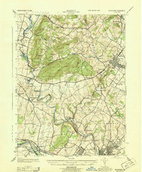
1943 Map of Boyertown
USGS Topo · Published 1943About this map
Boyertown and the southern reach of the Schuylkill River anchor this 1943 topographical survey, which details the complex industrial and residential landscape at the border of Berks and Montgomery counties. The winding course of Manatawny Creek connects several small settlements, including Pine Forge and Greshville, reflecting an older water-driven economy that predates the heavy rail and road expansion shown elsewhere. To the south, Pottstown appears as a dense urban hub, while the presence of the Schuylkill Canal running parallel to the river provides a clear reference for those tracing the evolution of regional transport. Distinctive peaks like Devils Hump, Fancy Hill, and Owl Head break the terrain, marking the geological character of the Earl and Colebrookdale townships. This map is particularly valuable for its depiction of small community clusters such as Little Oley, Glasgow, and New Berlinville during the mid-century era.
Find a feature on this map
47 named features on this map. Tap any name to fly to it.
Don’t see what you’re looking for? This feature index may not catch every label — zoom into the map to look around manually.
Map Details
Editions of this 1943 Boyertown Map
This is the sole edition of this map. No revisions or reprints were ever made.
Other maps of this area

1894 · Reading
USGS Topo · 1:62,500

1902 · Boyertown
USGS Topo · 1:62,500

1905 · Honey Brook
USGS Topo · 1:62,500

1906 · Phoenixville
USGS Topo · 1:62,500

1907 · Honeybrook
USGS Topo · 1:62,500

1913 · Reading
USGS Topo · 1:62,500

1915 · Reading
USGS Topo · 1:62,500

1941 · Honeybrook
USGS Topo · 1:62,500

1943 · Manatawny
USGS Topo · 1:31,680
1943 · East Greenville
USGS Topo · 1:31,680
Featured Places
- Pottstown, PA
- Colebrookdale, Douglass Township
- Boyertown, PA
- West Pottsgrove, PA
- Amity Gardens, Amity Township