2024 Map of Bozeman
USGS Topo · Published 2024About this map
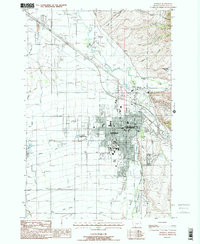
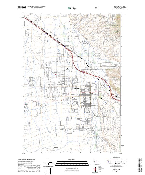
Bozeman serves as the focal point of this Gallatin Valley landscape, where urban expansion meets a complex network of agricultural irrigation. The campus of Montana State University anchors the southern portion of the city, while the eastern edge is defined by the rising elevations of the Bridger Range and the dramatic incision of Sypes Canyon. A legacy of water management is visible in the numerous ditches and canals, such as the Farmers Canal, West Gallatin Canal, and Middle Creek Ditch, which redirect local water to support the valley's farms.
Find a feature on this map
47 named features on this map. Tap any name to fly to it.
Don’t see what you’re looking for? This feature index may not catch every label — zoom into the map to look around manually.
Map Details
Editions of this 2024 Bozeman Map
This is the sole edition of this map. No revisions or reprints were ever made.
Historical Maps of Patterson Through Time
9 maps found