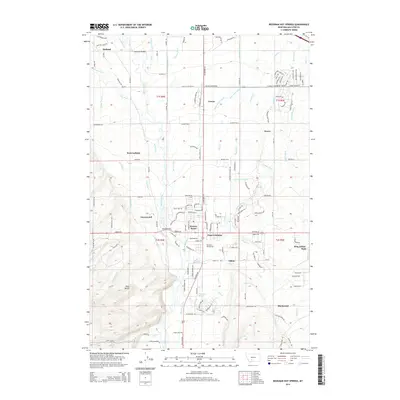
2014 Map of Bozeman Hot Springs
USGS Topo · Published 2014About this map
Gallatin River frontage and an intricate network of irrigation ditches define this Gallatin Valley landscape as it appeared in the early 21st century. The map highlights the transition from agricultural land to residential developments, centered around the junction of Four Corners and Bozeman Hot Springs. Water management is the dominant human imprint on the terrain, evidenced by the numerous man-made waterways like the Highline Canal, Farmers Canal, and Moreland Ditch that lace through the valley floor. Toward the southwest, the topography rises sharply at Pine Butte, contrasting with the level plains where settlements like Greenwood, Gilroy, and Blackwood are situated. The presence of named mobile home parks and subdivisions such as Korner Kourt and King Arthur Park provides a detailed look at the suburban expansion of the Bozeman area during this period.
Find a feature on this map
147 named features on this map. Tap any name to fly to it.
Don’t see what you’re looking for? This feature index may not catch every label — zoom into the map to look around manually.
Map Details
Editions of this 2014 Bozeman Hot Springs Map
This is the sole edition of this map. No revisions or reprints were ever made.
Other maps of this area

1888 · Three Forks
USGS Topo · 1:250,000

1894 · Three Forks
USGS Topo · 1:250,000

1895 · Three Forks
USGS Topo · 1:250,000

1947 · Bozeman
USGS Topo · 1:250,000

1948 · Bozeman
USGS Topo · 1:250,000

1949 · Anceney
USGS Topo · 1:62,500

1949 · Manhattan
USGS Topo · 1:62,500

1950 · Belgrade
USGS Topo · 1:62,500

1953 · Bozeman
USGS Topo · 1:62,500

1955 · Bozeman
USGS Topo · 1:250,000