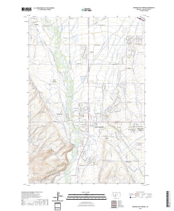
2024 Map of Bozeman Hot Springs
USGS Topo · Published 2024About this map
The Gallatin River valley serves as the central artery for this complex landscape of irrigation and settlement. A sophisticated network of man-made waterways, including the Highline Canal, Farmers Canal, and West Gallatin Canal, distributes water across the plains to support the agricultural heritage of the region. Localized communities like Four Corners and West Gallatin anchor the road network, while smaller named points such as Gilroy, Kerns, and Holland reflect the historical rural density. The presence of Bozeman Hot Springs highlights the unique geothermal character of the area, situated near the transition from the flat river valley to the rising terrain of Pine Butte. The intricate web of historic ditches, such as the Spain-Ferris-Fork Ditch and Ketterer Ditch, demonstrates a century-long reliance on shared water resources to define property and land use in Gallatin County.
Find a feature on this map
153 named features on this map. Tap any name to fly to it.
Don’t see what you’re looking for? This feature index may not catch every label — zoom into the map to look around manually.
Map Details
Editions of this 2024 Bozeman Hot Springs Map
This is the sole edition of this map. No revisions or reprints were ever made.
Other maps of this area

1888 · Three Forks
USGS Topo · 1:250,000

1894 · Three Forks
USGS Topo · 1:250,000

1895 · Three Forks
USGS Topo · 1:250,000

1947 · Bozeman
USGS Topo · 1:250,000

1948 · Bozeman
USGS Topo · 1:250,000

1949 · Anceney
USGS Topo · 1:62,500

1949 · Manhattan
USGS Topo · 1:62,500

1950 · Belgrade
USGS Topo · 1:62,500

1953 · Bozeman
USGS Topo · 1:62,500

1955 · Bozeman
USGS Topo · 1:250,000