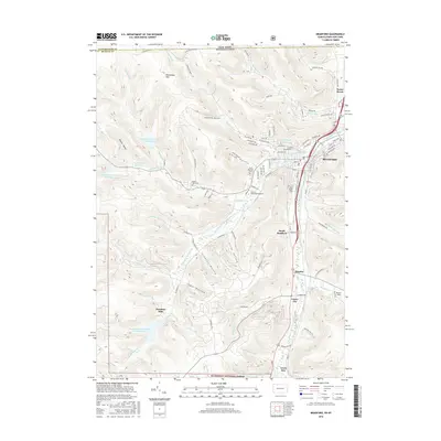
2016 Map of Bradford
USGS Topo · Published 2016About this map
Bradford serves as the industrial and social anchor of this valley landscape, where the Tunungwant Creek and its many branches like Marilla Brook and Bolivar Run have shaped both the terrain and the town's expansion. The complex topography is defined by narrow hollows such as Hedgehog Hollow and Gates Hollow, while the higher ground of Blacksnake Mtn overlooks a system of vital water resources, including the Bradford City Number Two Reservoir and Bradford City Number Five Reservoir. This 2016 survey documents the institutional footprint of the University of Pittsburgh-Bradford and the series of small communities like Degolia and Custer City that follow the valley floor southward toward the Allegheny National Forest. Local heritage is preserved in the detailed marking of sites like Oak Hill Cem and the footprint of Hazelton Mills.
Find a feature on this map
95 named features on this map. Tap any name to fly to it.
Don’t see what you’re looking for? This feature index may not catch every label — zoom into the map to look around manually.
Map Details
Editions of this 2016 Bradford Map
This is the sole edition of this map. No revisions or reprints were ever made.
Other maps of this area

1900 · Salamanca
USGS Topo · 1:62,500

1922 · Randolph
USGS Topo · 1:62,500

1923 · Randolph
USGS Topo · 1:62,500

1924 · Bradford
USGS Topo · 1:62,500

1926 · Bradford
USGS Topo · 1:62,500

1936 · Kinzua
USGS Topo · 1:48,000

1938 · Salamanca
USGS Topo · 1:62,500

1941 · Kinzua
USGS Topo · 1:62,500

1941 · Bradford
USGS Topo · 1:62,500

1943 · Randolph
USGS Topo · 1:62,500