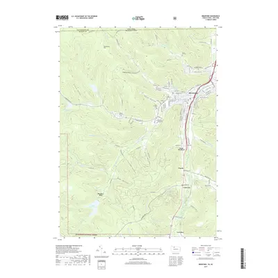
2019 Map of Bradford
USGS Topo · Published 2019About this map
Tunungwant Creek and its various branches, including the West Branch Tunungwant Creek, carve through the mountainous terrain of the Allegheny National Forest just south of the New York Pennsylvania state line. This landscape is defined by its deep hollows, such as Hedgehog Hollow, Gates Hollow, and Niles Hollow, which dictate the placement of local infrastructure and historic settlements. The city of Bradford sits at the confluence of several waterways, serving as the primary hub for the region.
Find a feature on this map
113 named features on this map. Tap any name to fly to it.
Don’t see what you’re looking for? This feature index may not catch every label — zoom into the map to look around manually.
Map Details
Editions of this 2019 Bradford Map
This is the sole edition of this map. No revisions or reprints were ever made.
Other maps of this area

1900 · Salamanca
USGS Topo · 1:62,500

1922 · Randolph
USGS Topo · 1:62,500

1923 · Randolph
USGS Topo · 1:62,500

1924 · Bradford
USGS Topo · 1:62,500

1926 · Bradford
USGS Topo · 1:62,500

1936 · Kinzua
USGS Topo · 1:48,000

1938 · Salamanca
USGS Topo · 1:62,500

1941 · Kinzua
USGS Topo · 1:62,500

1941 · Bradford
USGS Topo · 1:62,500

1943 · Randolph
USGS Topo · 1:62,500