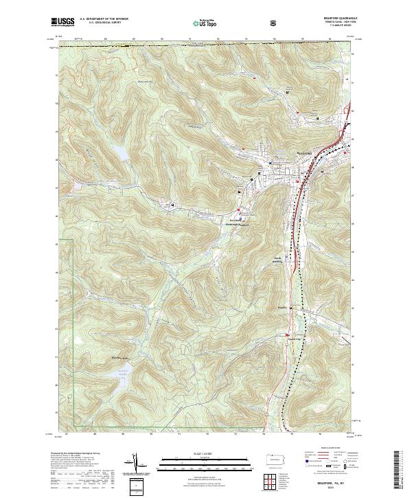
2023 Map of Bradford
USGS Topo · Published 2023About this map
The city of Bradford anchors this landscape, positioned at the confluence of the West Branch Tunungwant Creek and East Branch Tunungwant Creek. This topographic record illustrates a valley dense with municipal and cultural history, including the University of Pittsburgh Bradford and several distinct religious landmarks such as the Tefares Israel Congregation and Cem and Saint Bernards Cem. To the south, the industrial and residential corridors extend through South Bradford toward Degolia and Custer City.
Find a feature on this map
90 named features on this map. Tap any name to fly to it.
Don’t see what you’re looking for? This feature index may not catch every label — zoom into the map to look around manually.
Map Details
Editions of this 2023 Bradford Map
This is the sole edition of this map. No revisions or reprints were ever made.
Other maps of this area

1900 · Salamanca
USGS Topo · 1:62,500

1922 · Randolph
USGS Topo · 1:62,500

1923 · Randolph
USGS Topo · 1:62,500

1924 · Bradford
USGS Topo · 1:62,500

1926 · Bradford
USGS Topo · 1:62,500

1936 · Kinzua
USGS Topo · 1:48,000

1938 · Salamanca
USGS Topo · 1:62,500

1941 · Kinzua
USGS Topo · 1:62,500

1941 · Bradford
USGS Topo · 1:62,500

1943 · Randolph
USGS Topo · 1:62,500