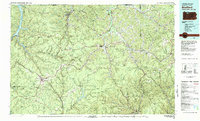
1980 Map of Bradford
USGS Topo · Published 1982About this map
The oil and gas fields of northern Pennsylvania dominate the high plateau country shown here in 1980, where the heavy industry of Bradford meets the dense woodlands of the Allegheny National Forest. This era shows a complex infrastructure supporting resource extraction, with extensive oil and gas fields blanketing the landscape between deep creek valleys. The regional transport network is anchored by the Baltimore and Ohio Railroad and Conrail, which wind through steep terrain to serve industrial settlements like Smethport and Mt Jewett.
Find a feature on this map
107 named features on this map. Tap any name to fly to it.
Don’t see what you’re looking for? This feature index may not catch every label — zoom into the map to look around manually.
Map Details
Editions of this 1980 Bradford Map
This is the sole edition of this map. No revisions or reprints were ever made.
Other maps of this area

1898 · Olean
USGS Topo · 1:62,500

1900 · Salamanca
USGS Topo · 1:62,500

1905 · Jamestown
USGS Topo · 1:62,500

1906 · Warren
USGS Topo · 1:62,500

1907 · Warren
USGS Topo · 1:62,500

1908 · Warren
USGS Topo · 1:62,500

1918 · Loleta
USGS Topo · 1:62,500

1922 · Randolph
USGS Topo · 1:62,500

1923 · Randolph
USGS Topo · 1:62,500

1924 · Bradford
USGS Topo · 1:62,500