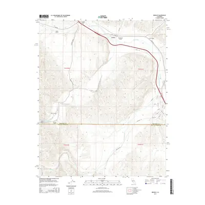
2015 Map of Bradley
USGS Topo · Published 2015About this map
Bradley serves as a central hub in this landscape where the Salinas River meets the canyon-cut terrain of southern Monterey County. The convergence of multiple major watercourses defines the local geography, with the San Antonio River and Nacimiento River flowing through the southern reaches while Hames Cr drains the northwestern corner. The map reveals a complex network of canyons such as Portuguese Canyon, Hare Canyon, and Buttle Canyon that separate high ridges from the fertile valley floor. This 2015 U.S. Geological Survey record captures the transportation infrastructure serving the area, including Jolon Rd and Nacimiento Lake Dr, which connect the rural settlement of Hames Valley to the broader region. The survey also clearly marks the Monterey Co San Luis Obispo Co line, providing a precise look at the jurisdictional boundary in a region defined by its hydrography and elevation.
Find a feature on this map
34 named features on this map. Tap any name to fly to it.
Don’t see what you’re looking for? This feature index may not catch every label — zoom into the map to look around manually.
Map Details
Editions of this 2015 Bradley Map
This is the sole edition of this map. No revisions or reprints were ever made.
Other maps of this area

1919 · San Miguel
USGS Topo · 1:62,500

1919 · Paso Robles
USGS Topo · 1:62,500

1919 · Bradley
USGS Topo · 1:62,500

1919 · Adelaida
USGS Topo · 1:62,500

1932 · Adelaida
USGS Topo · 1:62,500

1941 · Bradley
USGS Topo · 1:62,500

1942 · Adelaida
USGS Topo · 1:62,500

1943 · Paso Robles
USGS Topo · 1:62,500

1947 · San Luis Obispo
USGS Topo · 1:250,000

1947 · San Miguel
USGS Topo · 1:62,500