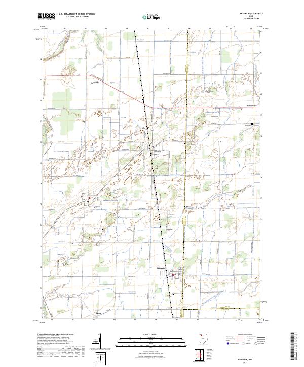
2023 Map of Bradner
USGS Topo · Published 2023About this map
Agricultural fields and small village centers define this portion of Northwest Ohio, where the borders of Wood, Sandusky, and Seneca counties converge. The village of Bradner serves as a central hub, surrounded by smaller settlements like Wayne, Risingsun, and the riverside hamlet of Woodside. The landscape is etched by a drainage network flowing toward Lake Erie, including the winding Portage River in the northwest and several tributaries such as Sugar Creek and Coon Creek. Local history and genealogy are preserved in rural burial grounds like the Pember Farm Cem and Graham Cem, while the orthogonal road grid—marked by names like Defiance Pike and Fostoria Rd—reflects the systematic township and range surveying of the Old Northwest. This modern survey captures the enduring rural character of the region, where legacy farmsteads remain connected to long-established crossroads like Rollersville and Hatton.
Find a feature on this map
81 named features on this map. Tap any name to fly to it.
Don’t see what you’re looking for? This feature index may not catch every label — zoom into the map to look around manually.
Map Details
Editions of this 2023 Bradner Map
This is the sole edition of this map. No revisions or reprints were ever made.
Other maps of this area

1901 · Fostoria
USGS Topo · 1:62,500

1901 · Bowling Green
USGS Topo · 1:62,500

1901 · Elmore
USGS Topo · 1:62,500

1903 · Bowling Green
USGS Topo · 1:62,500

1903 · Fostoria
USGS Topo · 1:62,500

1903 · Findlay
USGS Topo · 1:62,500

1903 · Elmore
USGS Topo · 1:62,500

1956 · Toledo
USGS Topo · 1:250,000
1958 · Dunbridge
USGS Topo · 1:24,000

1958 · Jerry City
USGS Topo · 1:24,000