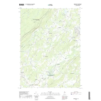
2019 Map of Branchville
USGS Topo · Published 2019About this map
Kittatinny Mtn and the Appalachian National Scenic Trail dominate the western ridgeline of this Sussex County landscape. The terrain transitions from the high elevation of Sunrise Mtn down into a valley marked by agricultural hamlets and watercourses like the Paulins Kill and Papakating Creek. Significant protected land is found within the Wallkill River National Wildlife Refuge in the southern portion of the quadrangle. Local history is anchored by long-standing settlements such as Beemerville, Wykertown, and Libertyville, which are connected by a network of rural roads and turnpikes. For genealogists, the map identifies the Beemerville Cem and Branchville Cem, providing precise locations for family research in these small communities. The map also captures the residential development around Lake Neepaulin and the industrial footprint of a Quarry near Augusta.
Find a feature on this map
142 named features on this map. Tap any name to fly to it.
Don’t see what you’re looking for? This feature index may not catch every label — zoom into the map to look around manually.
Map Details
Editions of this 2019 Branchville Map
This is the sole edition of this map. No revisions or reprints were ever made.
Other maps of this area

1888 · Franklin
USGS Topo · 1:62,500

1891 · Wallpack
USGS Topo · 1:62,500

1893 · Wallpack
USGS Topo · 1:62,500

1894 · Franklin
USGS Topo · 1:62,500

1897 · Franklin
USGS Topo · 1:62,500

1903 · Franklin Furnace
USGS Topo · 1:62,500

1906 · Port Jervis
USGS Topo · 1:62,500

1908 · Port Jervis
USGS Topo · 1:62,500

1913 · Milford
USGS Topo · 1:62,500

1915 · Milford
USGS Topo · 1:62,500