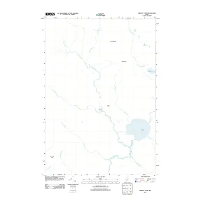
2011 Map of Brandy Pond
USGS Topo · Published 2011About this map
Thirty-Nine Tannery sits at the junction of Buffalo Stream and Little Buffalo Stream, marking a site of industrial activity amidst a landscape dominated by water and high ground. This area of Hancock County is characterized by a dense network of waterways, including Brandy Pond and Main Stream, which drainage patterns suggest have historically shaped the local movement and economy. To the north and west, elevations rise toward Lord Mountain, Buffalo Hill, and Baker Hill, while Spaulding Ridge defines the southwestern terrain. The 2011 survey records a remote territory of the Maine interior where named brooks like Pug Hole Brook, Runt Brook, and Scotch Brook feed into larger systems, illustrating the hydrological complexity of the region. Local historians and genealogists can use these specific water and terrain markers to pinpoint historical family landholdings and small-scale operations that once relied on these natural resources.
Find a feature on this map
21 named features on this map. Tap any name to fly to it.
Don’t see what you’re looking for? This feature index may not catch every label — zoom into the map to look around manually.
Map Details
Editions of this 2011 Brandy Pond Map
This is the sole edition of this map. No revisions or reprints were ever made.
Other maps of this area

1929 · Great Pond
USGS Topo · 1:48,000

1929 · Lead Mountain
USGS Topo · 1:48,000

1931 · Saponac
USGS Topo · 1:48,000

1932 · Nicatous Lake
USGS Topo · 1:48,000

1932 · Lead Mountain
USGS Topo · 1:62,500

1932 · Great Pond
USGS Topo · 1:62,500

1934 · Saponac
USGS Topo · 1:62,500

1934 · Nicatous Lake
USGS Topo · 1:62,500

1948 · Bangor
USGS Topo · 1:250,000

1954 · Millinocket
USGS Topo · 1:250,000