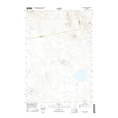
2014 Map of Brandy Pond
USGS Topo · Published 2014About this map
The Hancock and Penobscot county line cuts across this interior Maine landscape, dividing a network of drainages and prominent ridges. Dominating the eastern sector, Brandy Pond serves as a collection point for Guagus Stream and Indian Brook, eventually feeding into Brandy Stream. The terrain is defined by a series of significant elevations including Lord Mountain and Buffalo Hill, which rise above a complex system of waterways like Buffalo Stream and Pug Hole Brook.
Find a feature on this map
28 named features on this map. Tap any name to fly to it.
Don’t see what you’re looking for? This feature index may not catch every label — zoom into the map to look around manually.
Map Details
Editions of this 2014 Brandy Pond Map
This is the sole edition of this map. No revisions or reprints were ever made.
Other maps of this area

1929 · Great Pond
USGS Topo · 1:48,000

1929 · Lead Mountain
USGS Topo · 1:48,000

1931 · Saponac
USGS Topo · 1:48,000

1932 · Nicatous Lake
USGS Topo · 1:48,000

1932 · Lead Mountain
USGS Topo · 1:62,500

1932 · Great Pond
USGS Topo · 1:62,500

1934 · Saponac
USGS Topo · 1:62,500

1934 · Nicatous Lake
USGS Topo · 1:62,500

1948 · Bangor
USGS Topo · 1:250,000

1954 · Millinocket
USGS Topo · 1:250,000