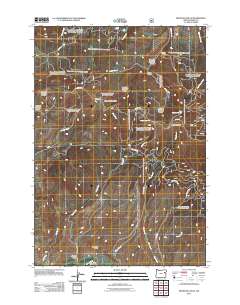
2011 Map of Brannan Gulch
USGS Topo · Published 2011About this map
Brannan Gulch and Browns Gulch occupy the southern reaches of this landscape, situated just north of the Burnt River as it winds through southern Baker County. The terrain is defined by a dense network of national forest roads and water features, including the Cleary Ditch and numerous seasonal drainages like Pine Creek and Cow Creek. This 2011 survey illustrates a land primarily managed for its natural resources and watershed, where high points like Little Bald Mountain and Bald Mountain overlook the drainage basins. The presence of Frog Spring and Bald Mountain Spring near the center of the sheet indicates vital water sources for local wildlife and grazing in this upland environment. Historically significant gulches, including Hervey Gulch and Buffalo Gulch, highlight a nomenclature rooted in the area's early prospecting and ranching history.
Find a feature on this map
30 named features on this map. Tap any name to fly to it.
Don’t see what you’re looking for? This feature index may not catch every label — zoom into the map to look around manually.
Map Details
Editions of this 2011 Brannan Gulch Map
This is the sole edition of this map. No revisions or reprints were ever made.
Other maps of this area

1901 · Baker City
USGS Topo · 1:125,000

1901 · Sumpter
USGS Topo · 1:125,000

1908 · Ironside Mountain
USGS Topo · 1:125,000

1955 · Baker
USGS Topo · 1:250,000

1955 · Canyon City
USGS Topo · 1:250,000

1959 · Baker
USGS Topo · 1:250,000

1959 · Canyon City
USGS Topo · 1:250,000

1964 · Ironside
USGS Topo · 1:62,500

1967 · Dooley Mtn
USGS Topo · 1:24,000

1967 · Blue Canyon
USGS Topo · 1:24,000