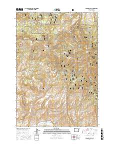
2017 Map of Brannan Gulch
USGS Topo · Published 2017About this map
Whitman National Forest land dominates this section of Baker County, where the topography is defined by high peaks and a complex network of gulches and drainage creeks. In the northern reaches, Black Mtn and Little Bald Mtn overlook a landscape carved by Spring Gulch and Rattlesnake Gulch. The southern portion of the map centers on the Burnt River corridor, where the presence of Reeds Ditch indicates a history of water management for local agriculture or industry. This 2017 survey details the access roads vital to this forested area, including Skyline Rd and Chinacamp Rd, which wind through timbered slopes near Bald Mtn. Local water sources like Frog Spring and Bald Mountain Spring provide essential landmarks for those navigating the high country between Cow Creek and Lake Creek.
Find a feature on this map
47 named features on this map. Tap any name to fly to it.
Don’t see what you’re looking for? This feature index may not catch every label — zoom into the map to look around manually.
Map Details
Editions of this 2017 Brannan Gulch Map
This is the sole edition of this map. No revisions or reprints were ever made.
Other maps of this area

1901 · Baker City
USGS Topo · 1:125,000

1901 · Sumpter
USGS Topo · 1:125,000

1908 · Ironside Mountain
USGS Topo · 1:125,000

1955 · Baker
USGS Topo · 1:250,000

1955 · Canyon City
USGS Topo · 1:250,000

1959 · Baker
USGS Topo · 1:250,000

1959 · Canyon City
USGS Topo · 1:250,000

1964 · Ironside
USGS Topo · 1:62,500

1967 · Dooley Mtn
USGS Topo · 1:24,000

1967 · Blue Canyon
USGS Topo · 1:24,000