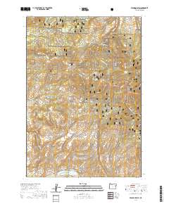
2020 Map of Brannan Gulch
USGS Topo · Published 2020About this map
The Burnt River winds along the southern edge of this Baker County landscape, serving as a primary drainage point for a complex network of canyons and gulches. Significant landmarks like Brannan Gulch and Browns Gulch descend toward the river valley, reflecting the area's characteristic water-management history through features like Reeds Ditch. Much of the territory is contained within the Whitman National Forest, where the terrain rises sharply toward Bald Mtn and Black Mtn. Evidence of historic transportation and industrial infrastructure remains visible through labels such as Old Trestle Ln and Railway Rd, suggesting a legacy of timber or mineral transport. Scattered water sources, including Frog Spring and Snag Spring, punctuate the high country, providing vital points of reference in this high-altitude Oregon environment.
Find a feature on this map
43 named features on this map. Tap any name to fly to it.
Don’t see what you’re looking for? This feature index may not catch every label — zoom into the map to look around manually.
Map Details
Editions of this 2020 Brannan Gulch Map
This is the sole edition of this map. No revisions or reprints were ever made.
Other maps of this area

1901 · Baker City
USGS Topo · 1:125,000

1901 · Sumpter
USGS Topo · 1:125,000

1908 · Ironside Mountain
USGS Topo · 1:125,000

1955 · Baker
USGS Topo · 1:250,000

1955 · Canyon City
USGS Topo · 1:250,000

1959 · Baker
USGS Topo · 1:250,000

1959 · Canyon City
USGS Topo · 1:250,000

1964 · Ironside
USGS Topo · 1:62,500

1967 · Dooley Mtn
USGS Topo · 1:24,000

1967 · Blue Canyon
USGS Topo · 1:24,000