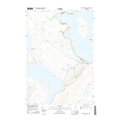
2014 Map of Brassua Lake East
USGS Topo · Published 2014About this map
Rockwood sits at the eastern edge of this landscape, positioned where the Moose River flows toward the vast waters of Moosehead Lake. The geography is defined by a dense network of timber roads and significant water bodies, including the expansive Brassua Lake to the west and the prominent Blue Ridge rising to the south. This area serves as a critical corridor for northern Maine's wilderness access, centered around the historic settlement and its proximity to notable landmarks like Farm Island and the secluded Baker Pond.
Find a feature on this map
47 named features on this map. Tap any name to fly to it.
Don’t see what you’re looking for? This feature index may not catch every label — zoom into the map to look around manually.
Map Details
Editions of this 2014 Brassua Lake East Map
This is the sole edition of this map. No revisions or reprints were ever made.
Other maps of this area

1920 · Moosehead Lake
USGS Topo · 1:62,500

1921 · Brassua Lake
USGS Topo · 1:62,500

1922 · Moosehead Lake
USGS Topo · 1:62,500

1923 · Brassua Lake
USGS Topo · 1:62,500

1930 · Moosehead Lake
USGS Topo · 1:62,500

1944 · Brassua Lake
USGS Topo · 1:62,500

1944 · Moosehead Lake
USGS Topo · 1:62,500

1954 · Seboomook Lake
USGS Topo · 1:62,500

1954 · North East Carry
USGS Topo · 1:62,500

1954 · Millinocket
USGS Topo · 1:250,000
Featured Places
- Rockwood Strip T2 R1 NBKP, ME
- Kineo Township, ME
- Tomhegan Township, ME
- Sandwich Academy Grant Township, ME
- Rockwood Strip T1 R1 NBKP, ME