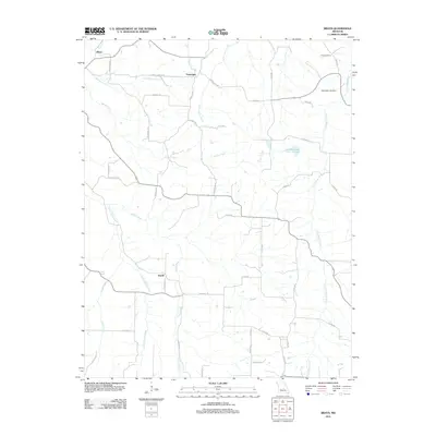
2011 Map of Brays
USGS Topo · Published 2011About this map
Brays and the rural communities of Traderight and Atwell anchor this part of Miller County, characterized by a complex drainage network feeding into the Little Maries River and Little Tavern Creek. The settlement pattern follows the high ground between these winding waterways, connected by a network of local roads such as Elm Springs Rd and Co Road K-14. Genealogists and local historians can trace family ties at Rose Cemetery and Washington Cemetery, or follow the namesake Brays Church Rd. The terrain is marked by numerous seasonal branches like Elm Springs Branch and Greasy Creek, which flow through the undulating landscape toward larger catchments like Joe Hanauer Lake. This document illustrates the persistent agricultural and residential character of the region during the early 21st century.
Find a feature on this map
47 named features on this map. Tap any name to fly to it.
Don’t see what you’re looking for? This feature index may not catch every label — zoom into the map to look around manually.
Map Details
Editions of this 2011 Brays Map
This is the sole edition of this map. No revisions or reprints were ever made.
Other maps of this area

1888 · Tuscumbia
USGS Topo · 1:125,000

1894 · Tuscumbia
USGS Topo · 1:125,000

1933 · Iberia
USGS Topo · 1:62,500

1936 · Waynesville
USGS Topo · 1:48,000

1937 · Iberia
USGS Topo · 1:62,500

1942 · Waynesville
USGS Topo · 1:62,500

1943 · Richland
USGS Topo · 1:62,500

1944 · Waynesville
USGS Topo · 1:62,500

1947 · Jefferson City
USGS Topo · 1:250,000

1948 · Tavern
USGS Topo · 1:62,500