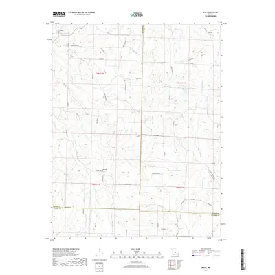
2017 Map of Brays
USGS Topo · Published 2017About this map
Brays and Atwell anchor this rural landscape along the borders of Miller, Maries, and Pulaski counties. The terrain is defined by a dense network of waterways, including the Little Maries River to the east and the winding Little Tavern Cr to the west. While much of the area consists of wooded drainage basins like Greasy Cr and Kenser Cr, the map reveals a history of local settlement through established road systems and small family or community landmarks.
Find a feature on this map
74 named features on this map. Tap any name to fly to it.
Don’t see what you’re looking for? This feature index may not catch every label — zoom into the map to look around manually.
Map Details
Editions of this 2017 Brays Map
This is the sole edition of this map. No revisions or reprints were ever made.
Other maps of this area

1888 · Tuscumbia
USGS Topo · 1:125,000

1894 · Tuscumbia
USGS Topo · 1:125,000

1933 · Iberia
USGS Topo · 1:62,500

1936 · Waynesville
USGS Topo · 1:48,000

1937 · Iberia
USGS Topo · 1:62,500

1942 · Waynesville
USGS Topo · 1:62,500

1943 · Richland
USGS Topo · 1:62,500

1944 · Waynesville
USGS Topo · 1:62,500

1947 · Jefferson City
USGS Topo · 1:250,000

1948 · Tavern
USGS Topo · 1:62,500