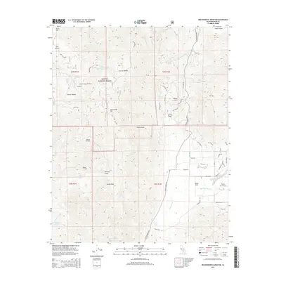
2015 Map of Breckenridge Mountain
USGS Topo · Published 2015About this map
Sequoia National Forest dominates this landscape in Kern County, centered on the high elevations of Breckenridge Mtn. The terrain is marked by a series of distinct alpine meadows and water sources, such as Munzer Meadow, Squirrel Meadow, and Barrel Spring. To the southeast, the geography transitions into the Walker Basin, where a more developed road network emerges, including Caliente Bodfish Rd and Walker Basin Rd. This area shows a cluster of localized residential development with named streets like Lake Ave and Jacaranda Dr near the Flying S Ranch Airport. The northern portion of the map is defined by steep drainage systems, including Haight Canyon and Havilah Canyon, illustrating the varied topography of the southern Sierra Nevada range.
Find a feature on this map
68 named features on this map. Tap any name to fly to it.
Don’t see what you’re looking for? This feature index may not catch every label — zoom into the map to look around manually.
Map Details
Editions of this 2015 Breckenridge Mountain Map
This is the sole edition of this map. No revisions or reprints were ever made.
Other maps of this area

1906 · Kernville
USGS Topo · 1:125,000

1908 · Kernville
USGS Topo · 1:125,000

1914 · Caliente
USGS Topo · 1:125,000

1915 · Mojave
USGS Topo · 1:125,000

1920 · Delonagha
USGS Topo · 1:62,500

1926 · Glennville
USGS Topo · 1:62,500

1929 · Bena
USGS Topo · 1:31,680

1932 · Bena
USGS Topo · 1:31,680

1936 · Tobias Peak
USGS Topo · 1:125,000

1943 · Emerald Mtn
USGS Topo · 1:62,500