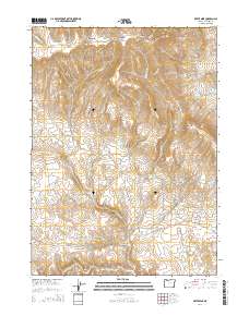
2014 Map of Bretz Mine
USGS Topo · Published 2014About this map
The Bretz Mine complex serves as a focal point for this industrial and hydraulic landscape in the Oregon Canyon Mountains. Water management is a defining characteristic of the terrain, with an extensive network of man-made catchments including the Little Pink Reservoir, Pinky Reservoir, and the Spring Cr Pit Reservoir. These features, along with names like Mendi Suri, reflect the specific land use and cultural history of this corner of Malheur County.
Find a feature on this map
40 named features on this map. Tap any name to fly to it.
Don’t see what you’re looking for? This feature index may not catch every label — zoom into the map to look around manually.
Map Details
Editions of this 2014 Bretz Mine Map
This is the sole edition of this map. No revisions or reprints were ever made.
Other maps of this area

1882 · Paradise
USGS Topo · 1:250,000

1886 · Disaster
USGS Topo · 1:250,000

1893 · Paradise
USGS Topo · 1:250,000

1893 · Disaster
USGS Topo · 1:250,000

1954 · Vya
USGS Topo · 1:250,000

1955 · McDermitt
USGS Topo · 1:250,000

1955 · Jordan Valley
USGS Topo · 1:250,000

1955 · Adel
USGS Topo · 1:250,000

1957 · Adel
USGS Topo · 1:250,000

1957 · Jordan Valley
USGS Topo · 1:250,000