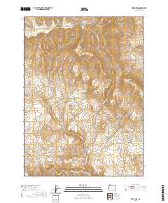
2020 Map of Bretz Mine
USGS Topo · Published 2020About this map
The Oregon Canyon Mountains dominate this high-desert landscape in Malheur County, where complex drainage systems and water management define the terrain. The presence of the Bretz Mine and its namesake Bretz Reservoir reflects the industrial activity and resource extraction that shaped this corner of Oregon. Ranching history is visible through named infrastructure such as Archie Myers Ranch Rd and numerous stock water features like Myers Reservoir, Little Pink Reservoir, and Pretty Rock Reservoir. These water sources are strategically placed among the many canyons, including Angel Canyon, Buck Corral Canyon, and Moonshine Canyon, highlighting the necessity of water management for survival in this arid environment. The map also shows significant elevation markers like Mendi Suri and the plateau known as Flattop.
Find a feature on this map
38 named features on this map. Tap any name to fly to it.
Don’t see what you’re looking for? This feature index may not catch every label — zoom into the map to look around manually.
Map Details
Editions of this 2020 Bretz Mine Map
This is the sole edition of this map. No revisions or reprints were ever made.
Other maps of this area

1882 · Paradise
USGS Topo · 1:250,000

1886 · Disaster
USGS Topo · 1:250,000

1893 · Paradise
USGS Topo · 1:250,000

1893 · Disaster
USGS Topo · 1:250,000

1954 · Vya
USGS Topo · 1:250,000

1955 · McDermitt
USGS Topo · 1:250,000

1955 · Jordan Valley
USGS Topo · 1:250,000

1955 · Adel
USGS Topo · 1:250,000

1957 · Adel
USGS Topo · 1:250,000

1957 · Jordan Valley
USGS Topo · 1:250,000