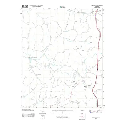
2010 Map of Brick Church
USGS Topo · Published 2010About this map
Richland Creek and Robertson Fork Creek define the drainage of this Tennessee landscape, where the rural character is preserved in numerous family-named hollows and small-scale water features. The area's settlement history is prominently visible through a high density of burial sites, including Brick Church Cemetery, Mars Hill Cemetery, and Simpson Chapel Cemetery. These sites, often located near local watercourses like Clear Creek and Clock Creek, speak to the long-standing community foundations in this part of Marshall County.
Find a feature on this map
83 named features on this map. Tap any name to fly to it.
Don’t see what you’re looking for? This feature index may not catch every label — zoom into the map to look around manually.
Map Details
Editions of this 2010 Brick Church Map
This is the sole edition of this map. No revisions or reprints were ever made.
Other maps of this area

1936 · Milky Way
USGS Topo · 1:24,000

1936 · Cornersville
USGS Topo · 1:24,000

1936 · Lewisburg
USGS Topo · 1:24,000

1936 · Brick Church
USGS Topo · 1:24,000

1936 · Campbells Station
USGS Topo · 1:24,000

1936 · Pulaski
USGS Topo · 1:24,000

1936 · Tarpley
USGS Topo · 1:24,000

1936 · Frankewing
USGS Topo · 1:24,000

1936 · Lynnville
USGS Topo · 1:24,000

1946 · Brick Church
USGS Topo · 1:24,000