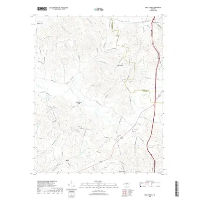
2019 Map of Brick Church
USGS Topo · Published 2019About this map
Richland Creek and its many tributaries, including Blue Creek and Anderson Branch, define the rolling topography of the Tennessee countryside near the border of Giles and Marshall Counties. This rural landscape is heavily marked by small family and community burial grounds, such as Franklin Cemetery and Dabney Cemetery, which dot the hillsides between various hollows. The settlement at Brick Church serves as a local landmark, accompanied by the nearby Brick Church Cemetery and Burton Cemetery.
Find a feature on this map
95 named features on this map. Tap any name to fly to it.
Don’t see what you’re looking for? This feature index may not catch every label — zoom into the map to look around manually.
Map Details
Editions of this 2019 Brick Church Map
This is the sole edition of this map. No revisions or reprints were ever made.
Other maps of this area

1936 · Milky Way
USGS Topo · 1:24,000

1936 · Cornersville
USGS Topo · 1:24,000

1936 · Lewisburg
USGS Topo · 1:24,000

1936 · Brick Church
USGS Topo · 1:24,000

1936 · Campbells Station
USGS Topo · 1:24,000

1936 · Pulaski
USGS Topo · 1:24,000

1936 · Tarpley
USGS Topo · 1:24,000

1936 · Frankewing
USGS Topo · 1:24,000

1936 · Lynnville
USGS Topo · 1:24,000

1946 · Brick Church
USGS Topo · 1:24,000