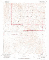
1970 Map of Bridge Canyon
USGS Topo · Published 1973About this map
Petroglyphs and freshwater sources define this 1970 desert landscape within the Newberry Mountains. This map documents a region where ancient cultural markers meet modern infrastructure, notably at Hiko Springs and along the eastern reaches of the Lake Mead National Recreation Area. The terrain is characterized by deep erosional features like Grapevine Canyon and Bridge Canyon, which provide critical drainage for the seasonal Grapevine Wash.
Find a feature on this map
19 named features on this map. Tap any name to fly to it.
Don’t see what you’re looking for? This feature index may not catch every label — zoom into the map to look around manually.
Map Details
Editions of this 1970 Bridge Canyon Map
2 editions found
Other maps of this area

1886 · Camp Mohave
USGS Topo · 1:250,000

1892 · Camp Mohave
USGS Topo · 1:250,000

1926 · Mohave City
USGS Topo · 1:96,000

1942 · Camp Mohave
USGS Topo · 1:250,000

1947 · Kingman
USGS Topo · 1:250,000

1948 · Kingman
USGS Topo · 1:250,000

1950 · Davis Dam
USGS Topo · 1:62,500

1952 · Davis Dam
USGS Topo · 1:62,500

1954 · Kingman
USGS Topo · 1:250,000

1955 · Kingman
USGS Topo · 1:250,000