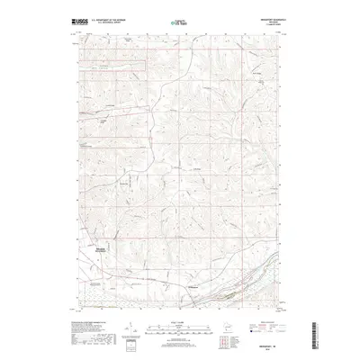
2018 Map of Bridgeport
USGS Topo · Published 2018About this map
The confluence of the Wisconsin River and the Mississippi valley defines the landscape of this Crawford County region, where the settlement of Bridgeport serves as a focal point for the surrounding highlands. The topography is marked by a series of prominent ridges and deep hollows, including Irish Ridge, Limery Ridge, and Tucker Hollow, which dictate the winding paths of local roads like Rhein Hollow Rd and Dutch Ridge Rd. Along the western edge, the outskirts of Prairie du Chien are visible, featuring the Prairie du Chien Municipal Airport and the residential clusters at Mondell Hill. This survey captures the rural character of the area, punctuated by small family and community burial grounds such as German Ridge Cem and Bridgeport Cem, which offer significant value for genealogical research in this part of the Driftless Area.
Find a feature on this map
73 named features on this map. Tap any name to fly to it.
Don’t see what you’re looking for? This feature index may not catch every label — zoom into the map to look around manually.
Map Details
Editions of this 2018 Bridgeport Map
This is the sole edition of this map. No revisions or reprints were ever made.
Other maps of this area

1900 · Lancaster
USGS Topo · 1:125,000

1902 · Elkader
USGS Topo · 1:125,000

1903 · Waukon
USGS Topo · 1:125,000

1904 · Lancaster
USGS Topo · 1:125,000

1908 · Lancaster
USGS Topo · 1:125,000

1926 · Wauzeka
USGS Topo · 1:62,500

1929 · Prairie Du Chien
USGS Topo · 1:62,500

1932 · Prairie Du Chien
USGS Topo · 1:62,500

1958 · La Crosse
USGS Topo · 1:250,000

1959 · Dubuque
USGS Topo · 1:250,000