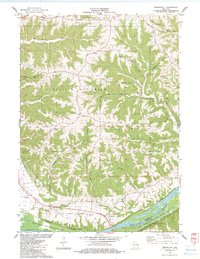
1983 Map of Bridgeport
USGS Topo · Published 1983About this map
Bridgeport occupies a strategic position above the Wisconsin River in the early 1980s, where the Chicago Milwaukee St Paul and Pacific railroad tracks follow the northern bank. The landscape is defined by the high ridges and deep coulees characteristic of the Driftless Area, including Famechon Ridge, Campbell Ridge, and Irish Ridge. These features dictate the winding paths of rural routes like Vineyard Coulee Road and Biederman Hill Road.
Find a feature on this map
52 named features on this map. Tap any name to fly to it.
Don’t see what you’re looking for? This feature index may not catch every label — zoom into the map to look around manually.
Map Details
Editions of this 1983 Bridgeport Map
This is the sole edition of this map. No revisions or reprints were ever made.
Other maps of this area

1900 · Lancaster
USGS Topo · 1:125,000

1902 · Elkader
USGS Topo · 1:125,000

1903 · Waukon
USGS Topo · 1:125,000

1904 · Lancaster
USGS Topo · 1:125,000

1908 · Lancaster
USGS Topo · 1:125,000

1926 · Wauzeka
USGS Topo · 1:62,500

1929 · Prairie Du Chien
USGS Topo · 1:62,500

1932 · Prairie Du Chien
USGS Topo · 1:62,500

1958 · La Crosse
USGS Topo · 1:250,000

1959 · Dubuque
USGS Topo · 1:250,000