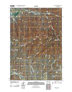
2011 Map of Bridgeport
USGS Topo · Published 2011About this map
The Burnt River flows through the northern reaches of this landscape, anchoring the settlement at Bridgeport, where the Bridgeport Post Office and Bridgeport Cemetery serve as local landmarks. The area's history of hydraulic engineering is visible through an extensive network of water management features, including the Eldorado Ditch, Wendt Ditch, and Birch Creek Ditch, which traverse the terrain to support mining or agricultural interests.
Find a feature on this map
59 named features on this map. Tap any name to fly to it.
Don’t see what you’re looking for? This feature index may not catch every label — zoom into the map to look around manually.
Map Details
Editions of this 2011 Bridgeport Map
This is the sole edition of this map. No revisions or reprints were ever made.
Other maps of this area
1901 · Baker City
USGS Topo · 1:125,000

1955 · Baker
USGS Topo · 1:250,000

1959 · Baker
USGS Topo · 1:250,000
1964 · Bridgeport
USGS Topo · 1:62,500
1964 · Ironside
USGS Topo · 1:62,500
1967 · French Gulch
USGS Topo · 1:24,000

1967 · Dooley Mtn
USGS Topo · 1:24,000
1967 · Lost Basin
USGS Topo · 1:24,000
1980 · Brogan
USGS Topo · 1:100,000
1981 · Baker
USGS Topo · 1:100,000