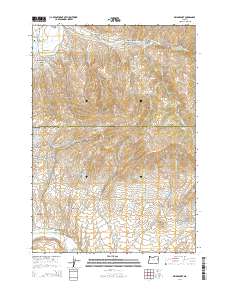
2014 Map of Bridgeport
USGS Topo · Published 2014About this map
Bridgeport Valley and the surrounding high country along the Baker and Malheur county line are defined by a complex network of historic water management features. The landscape is crisscrossed by several irrigation and mining-era watercourses, including the Clarks Cr Ditch, Wendt Ditch, and Eldorado Ditch, which speak to the area's intensive historical efforts to divert water for local industry and agriculture. Small settlements such as Bridgeport, Clarksville, and Eldorado are connected by rugged corridors like the Mormon Basin Rd and the Snake Riv-Mormon Basn Bck Cntry Bywy. Genealogists and local historians can locate the Bridgeport Cem near the Burnt River and the Malheur Cem further south, providing specific points of interest for family research in this high-elevation region of Eastern Oregon.
Find a feature on this map
77 named features on this map. Tap any name to fly to it.
Don’t see what you’re looking for? This feature index may not catch every label — zoom into the map to look around manually.
Map Details
Editions of this 2014 Bridgeport Map
This is the sole edition of this map. No revisions or reprints were ever made.
Other maps of this area

1901 · Baker City
USGS Topo · 1:125,000

1955 · Baker
USGS Topo · 1:250,000

1959 · Baker
USGS Topo · 1:250,000

1964 · Bridgeport
USGS Topo · 1:62,500

1964 · Ironside
USGS Topo · 1:62,500

1967 · French Gulch
USGS Topo · 1:24,000

1967 · Dooley Mtn
USGS Topo · 1:24,000

1967 · Lost Basin
USGS Topo · 1:24,000

1980 · Brogan
USGS Topo · 1:100,000

1981 · Baker
USGS Topo · 1:100,000