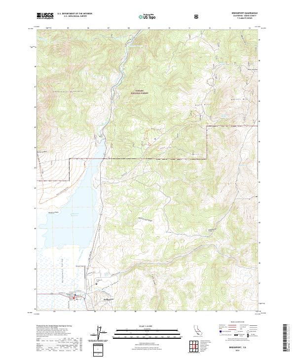
2021 Map of Bridgeport
USGS Topo · Published 2021About this map
Bridgeport serves as the focal point of this Eastern Sierra landscape, situated at the edge of the Bridgeport Valley and the Bridgeport Reservoir. This modern survey highlights the town's civic infrastructure, including the historic Mono County Courthouse, the Bridgeport Post Office, and Bryant Field. The surrounding terrain is defined by the high elevations of the Toiyabe National Forest, where the Sweetwater Mountains and the Bodie Hills frame the basin. Local water sources like the East Walker River and various springs such as McMillan Spring and Logan Spring underscore the importance of water management in this arid region. The map also traces the winding courses of Aurora Canyon and Boone Canyon, providing a clear record of the transportation network including Sweet Water Rd and the Masonic Loop-Trl.
Find a feature on this map
45 named features on this map. Tap any name to fly to it.
Don’t see what you’re looking for? This feature index may not catch every label — zoom into the map to look around manually.
Map Details
Editions of this 2021 Bridgeport Map
This is the sole edition of this map. No revisions or reprints were ever made.
Other maps of this area

1909 · Bridgeport
USGS Topo · 1:125,000

1911 · Bridgeport
USGS Topo · 1:125,000

1920 · Bridgeport
USGS Topo · 1:125,000

1948 · Walker Lake
USGS Topo · 1:250,000

1956 · Fales Hot Springs
USGS Topo · 1:62,500

1956 · Matterhorn Peak
USGS Topo · 1:62,500

1957 · Walker Lake
USGS Topo · 1:250,000

1958 · Bodie
USGS Topo · 1:62,500
1958 · Bridgeport
USGS Topo · 1:62,500

1962 · Walker Lake
USGS Topo · 1:250,000