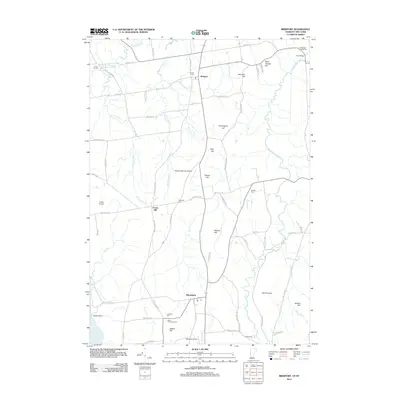
2012 Map of Bridport
USGS Topo · Published 2012About this map
The agricultural uplands of Bridport and Shoreham dominate this survey, situated just inland from the eastern shore of Lake Champlain. The landscape is defined by a dense network of country roads connecting scattered farmsteads and small landing strips such as Melrose Springs Airfield and Torrey Airport. Significant local watercourses, including the Lemon Fair River and several branches of W Br Dead Cr, wind through the terrain between prominent local heights like Saint George Hill and Hemingway Hill. Genealogists will find a high concentration of small burial grounds serving these rural communities, ranging from the Northwest Cornwall Cem at the northern edge to the Knapp Cem in the south. The presence of Fair Bridge across the Lemon Fair River and the designated Po in Shoreham highlight the enduring structure of these Vermont agricultural centers.
Find a feature on this map
74 named features on this map. Tap any name to fly to it.
Don’t see what you’re looking for? This feature index may not catch every label — zoom into the map to look around manually.
Map Details
Editions of this 2012 Bridport Map
This is the sole edition of this map. No revisions or reprints were ever made.
Other maps of this area

1894 · Port Henry
USGS Topo · 1:62,500

1894 · Ticonderoga
USGS Topo · 1:62,500

1896 · Ticonderoga
USGS Topo · 1:62,500

1898 · Port Henry
USGS Topo · 1:62,500

1902 · Ticonderoga
USGS Topo · 1:62,500

1902 · Brandon
USGS Topo · 1:62,500

1903 · Middlebury
USGS Topo · 1:62,500

1904 · Brandon
USGS Topo · 1:62,500

1905 · Middlebury
USGS Topo · 1:62,500

1920 · Brandon
USGS Topo · 1:62,500