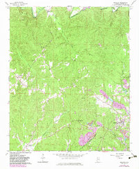
1967 Map of Brilliant
USGS Topo · Published 1983About this map
Brilliant serves as the primary hub in this corner of Marion County, where the industrial landscape of the late twentieth century is defined by the Burlington Northern railroad and numerous extractive sites. The 1982 photorevisions highlight significant land use changes, particularly a large Strip Mine and various Gravel Pit locations that dot the terrain. These industrial features contrast with the established rural network of small communities such as Pearces Mills, Pull Tight, and Yampertown (Twin).
Find a feature on this map
42 named features on this map. Tap any name to fly to it.
Don’t see what you’re looking for? This feature index may not catch every label — zoom into the map to look around manually.
Map Details
Editions of this 1967 Brilliant Map
3 editions found
Other maps of this area

1936 · South Of Hackleburg
USGS Topo · 1:24,000

1936 · Goddard
USGS Topo · 1:24,000

1953 · Birmingham
USGS Topo · 1:250,000

1956 · Birmingham
USGS Topo · 1:250,000

1956 · Gadsden
USGS Topo · 1:250,000

1957 · Birmingham
USGS Topo · 1:250,000

1958 · Gadsden
USGS Topo · 1:250,000
1958 · Haleyville West
USGS Topo · 1:24,000

1958 · Gold Mine
USGS Topo · 1:24,000

1960 · Gadsden
USGS Topo · 1:250,000