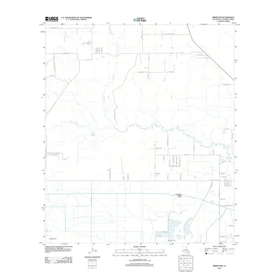
2012 Map of Brimstone
USGS Topo · Published 2012About this map
The Houston River and the Houston River Canal define the low-lying drainage of this Calcasieu Parish landscape. The area is heavily marked by the legacy of early 20th-century extraction, with the Edgerly Oil Field and Sulphur Oil Field anchoring the southern corners of the map. These industrial sites sit within a grid of family-named roads and rural infrastructure, including Marcantel Settlement Rd and Luther Marcantel Rd, which reflect the ancestral holdings of the Marcantel family. The interior remains dominated by watercourses like Buxton Cr and Cowards Gully, while significant transit corridors such as the Edgerly Dequincy Rd and Rte-66 suggest a landscape designed for moving resources and reaching remote homesteads like those along Richard's Pond Rd and Payton's Place Rd.
Find a feature on this map
66 named features on this map. Tap any name to fly to it.
Don’t see what you’re looking for? This feature index may not catch every label — zoom into the map to look around manually.
Map Details
Editions of this 2012 Brimstone Map
This is the sole edition of this map. No revisions or reprints were ever made.
Other maps of this area

1932 · Orange
USGS Topo · 1:62,500

1935 · Buhler
USGS Topo · 1:31,680

1935 · Gordon
USGS Topo · 1:31,680

1947 · Sulphur
USGS Topo · 1:31,680

1947 · Vinton
USGS Topo · 1:31,680

1947 · DeQuincy
USGS Topo · 1:31,680

1947 · Sulphur Mines
USGS Topo · 1:31,680
1947 · West Lake
USGS Topo · 1:31,680

1947 · Lunita
USGS Topo · 1:31,680

1947 · Long Marsh
USGS Topo · 1:31,680