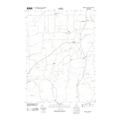
2010 Map of Bristol Center
USGS Topo · Published 2010About this map
Bristol Valley forms the central corridor of this Ontario County landscape, where the meandering course of Mud Creek defines the local topography and settlement patterns. Numerous small hamlets and historical corners are scattered throughout the region, including Bristol Center, South Bloomfield, and Baptist Hill. This map is particularly valuable for genealogical research, as it documents a high concentration of small burial grounds such as Wheeler Cemetery, Codding Cemetery, and Doyle Cemetery, many of which are associated with early families of the area. The western edge is defined by the sharp descents of Abbey Gulf and Jason Gully, while southern elevations rise toward Stid Hill and Johnson Hill. This 2010 edition serves as a precise record of the rural road network and the enduring agricultural character of the Finger Lakes region prior to more recent development.
Find a feature on this map
80 named features on this map. Tap any name to fly to it.
Don’t see what you’re looking for? This feature index may not catch every label — zoom into the map to look around manually.
Map Details
Editions of this 2010 Bristol Center Map
This is the sole edition of this map. No revisions or reprints were ever made.
Other maps of this area

1900 · Naples
USGS Topo · 1:62,500

1900 · Canandaigua
USGS Topo · 1:62,500

1901 · Honeoye
USGS Topo · 1:62,500

1902 · Wayland
USGS Topo · 1:62,500

1903 · Naples
USGS Topo · 1:62,500

1903 · Canandaigua
USGS Topo · 1:62,500

1904 · Wayland
USGS Topo · 1:62,500

1904 · Honeoye
USGS Topo · 1:62,500

1913 · Naples
USGS Topo · 1:62,500
1934 · Honeoye Falls
USGS Topo · 1:24,000