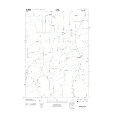
2013 Map of Bristol Center
USGS Topo · Published 2013About this map
Mud Cr and its tributaries carve a series of deep ravines across this Ontario County landscape, most notably at Reed Gully, Randall Gully, and Center Gully. This 2013 survey of the Finger Lakes region reveals a rural network of small hamlets and agricultural crossroads, such as South Bloomfield and Bristol Center. For genealogists, the map provides precise locations for several family-named burial grounds, including Andrews Cem, Codding Cem, and the Wheeler Cem. The terrain transitions from the broader flats of Egypt Valley in the west to the higher elevations surrounding Berby Hollow in the south. The area’s recreational character is noted at the Bristol Woodlands Campground, while its historical religious centers are anchored by Bristol Hill and the adjacent Baptist Hill Cem.
Find a feature on this map
105 named features on this map. Tap any name to fly to it.
Don’t see what you’re looking for? This feature index may not catch every label — zoom into the map to look around manually.
Map Details
Editions of this 2013 Bristol Center Map
This is the sole edition of this map. No revisions or reprints were ever made.
Other maps of this area

1900 · Naples
USGS Topo · 1:62,500

1900 · Canandaigua
USGS Topo · 1:62,500

1901 · Honeoye
USGS Topo · 1:62,500

1902 · Wayland
USGS Topo · 1:62,500

1903 · Naples
USGS Topo · 1:62,500

1903 · Canandaigua
USGS Topo · 1:62,500

1904 · Wayland
USGS Topo · 1:62,500

1904 · Honeoye
USGS Topo · 1:62,500

1913 · Naples
USGS Topo · 1:62,500
1934 · Honeoye Falls
USGS Topo · 1:24,000