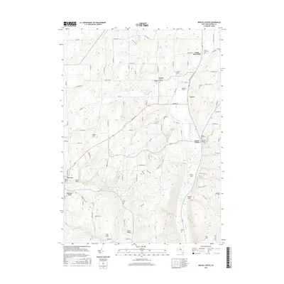
2016 Map of Bristol Center
USGS Topo · Published 2016About this map
Mud Cr carves a path through the heart of this landscape, defining a network of deep ravines and ridges in Ontario County. The settlement patterns follow these contours, with Bristol Center and Vincent situated along the valley floors while agricultural tracts and rural homesteads occupy the higher ground. The map reveals a dense concentration of historical burial sites, including the Baptist Hill Cem and South Bloomfield Cem, which serve as vital markers of early community roots for local genealogists. Striking geographical features like Abbey Gulf and Egypt Valley showcase the dramatic relief of the Finger Lakes region, where steep-sided gullies such as Jason Gully and Center Gully feed into the primary creek system. This 2016 survey documents the modern road network, from Baptist Hill Rd to Bristol Valley Rd, superimposed over a land still largely defined by its natural drainage patterns and ancestral family-named locations.
Find a feature on this map
98 named features on this map. Tap any name to fly to it.
Don’t see what you’re looking for? This feature index may not catch every label — zoom into the map to look around manually.
Map Details
Editions of this 2016 Bristol Center Map
This is the sole edition of this map. No revisions or reprints were ever made.
Other maps of this area

1900 · Naples
USGS Topo · 1:62,500

1900 · Canandaigua
USGS Topo · 1:62,500

1901 · Honeoye
USGS Topo · 1:62,500

1902 · Wayland
USGS Topo · 1:62,500

1903 · Naples
USGS Topo · 1:62,500

1903 · Canandaigua
USGS Topo · 1:62,500

1904 · Wayland
USGS Topo · 1:62,500

1904 · Honeoye
USGS Topo · 1:62,500

1913 · Naples
USGS Topo · 1:62,500
1934 · Honeoye Falls
USGS Topo · 1:24,000