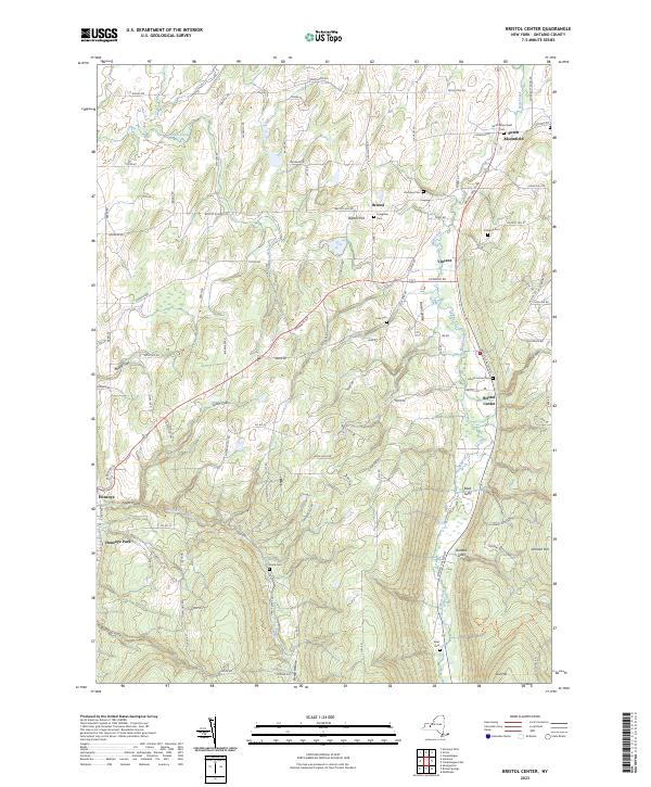
2023 Map of Bristol Center
USGS Topo · Published 2023About this map
Mud Creek and Mill Creek cut through the steep Ontario County landscape, defining the character of this rural region. The map reveals a high concentration of family-named burial grounds including South Bloomfield Cem, Andrews Cem, and Codding Cem, which serve as vital touchstones for genealogical research in this part of New York. The terrain is marked by deep erosional features like Abbey Gulf and Reed Gully, which create a complex system of ridges and valleys that dictate the paths of Bristol Valley Rd and other local routes. Settlements such as Bristol Center and Baptist Hill are situated at key crossroads, while the western edge captures the community of Honeoye Park. This 2023 edition documents the persistent settlement patterns and land use within the Bristol Valley, where many original family landmarks and cemetery names have remained consistent for generations.
Find a feature on this map
99 named features on this map. Tap any name to fly to it.
Don’t see what you’re looking for? This feature index may not catch every label — zoom into the map to look around manually.
Map Details
Editions of this 2023 Bristol Center Map
This is the sole edition of this map. No revisions or reprints were ever made.
Other maps of this area

1900 · Naples
USGS Topo · 1:62,500

1900 · Canandaigua
USGS Topo · 1:62,500

1901 · Honeoye
USGS Topo · 1:62,500

1902 · Wayland
USGS Topo · 1:62,500

1903 · Naples
USGS Topo · 1:62,500

1903 · Canandaigua
USGS Topo · 1:62,500

1904 · Wayland
USGS Topo · 1:62,500

1904 · Honeoye
USGS Topo · 1:62,500

1913 · Naples
USGS Topo · 1:62,500
1934 · Honeoye Falls
USGS Topo · 1:24,000