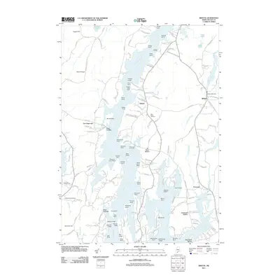
2011 Map of Bristol
USGS Topo · Published 2011About this map
The Damariscotta River and the Pemaquid River define this coastal landscape, shaping a series of jagged peninsulas and islands that have supported maritime communities for generations. In the village of Bristol, the Bristol Mills Dam marks the head of the tide where industry once flourished. To the west, the settlements of Walpole and West Bristol sit above the riverbanks, with the West Bristol Cemetery providing a genealogical record of the area's residents.
Find a feature on this map
162 named features on this map. Tap any name to fly to it.
Don’t see what you’re looking for? This feature index may not catch every label — zoom into the map to look around manually.
Map Details
Editions of this 2011 Bristol Map
This is the sole edition of this map. No revisions or reprints were ever made.
Other maps of this area

1893 · Wiscasset
USGS Topo · 1:62,500

1893 · Boothbay
USGS Topo · 1:62,500

1904 · Monhegan
USGS Topo · 1:62,500

1906 · Monhegan
USGS Topo · 1:62,500

1913 · Waldoboro
USGS Topo · 1:48,000

1915 · Waldoboro
USGS Topo · 1:62,500

1941 · Waldoboro
USGS Topo · 1:62,500

1941 · Boothbay
USGS Topo · 1:62,500

1943 · Boothbay
USGS Topo · 1:62,500

1944 · Wiscasset
USGS Topo · 1:62,500