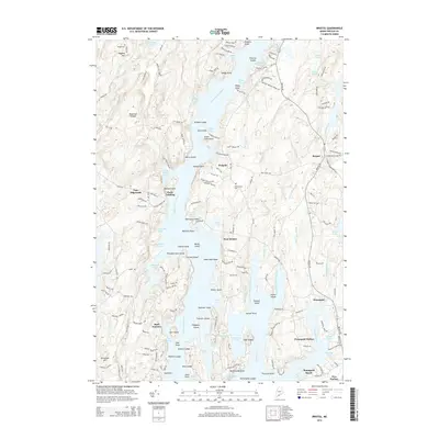
2014 Map of Bristol
USGS Topo · Published 2014About this map
Pemaquid Harbor and the surrounding coastline of Lincoln County are defined by a complex network of tidal rivers, coves, and rocky islands. The Damariscotta River and Johns River dominate the landscape, framing settlements such as Walpole and West Bristol. The map captures the seafaring character of this region, where the land is fragmented into numerous points and necks, including Bennett Neck and Wentworth Point.
Find a feature on this map
172 named features on this map. Tap any name to fly to it.
Don’t see what you’re looking for? This feature index may not catch every label — zoom into the map to look around manually.
Map Details
Editions of this 2014 Bristol Map
This is the sole edition of this map. No revisions or reprints were ever made.
Other maps of this area

1893 · Wiscasset
USGS Topo · 1:62,500

1893 · Boothbay
USGS Topo · 1:62,500

1904 · Monhegan
USGS Topo · 1:62,500

1906 · Monhegan
USGS Topo · 1:62,500

1913 · Waldoboro
USGS Topo · 1:48,000

1915 · Waldoboro
USGS Topo · 1:62,500

1941 · Waldoboro
USGS Topo · 1:62,500

1941 · Boothbay
USGS Topo · 1:62,500

1943 · Boothbay
USGS Topo · 1:62,500

1944 · Wiscasset
USGS Topo · 1:62,500