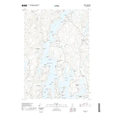
2021 Map of Bristol
USGS Topo · Published 2021About this map
The Narrows and the Damariscotta River dominate this coastal landscape, where the irregular Maine shoreline creates a complex system of coves and islands. The village of Bristol and the surrounding area are marked by numerous small family and community burial grounds, including the McFarland - Erskine Family Cem and the Stephen Bryer Farm Cem, offering significant detail for local genealogical study. The geography is characterized by prominent points such as Fitch Point and Wentworth Point, which define the many sheltered waters like Seal Cove and Mears Cove. Land use patterns show a mix of coastal settlements like New Harbor and Pemaquid Beach alongside interior landmarks such as Mt Hunger and Haggett Hill. The road network, including Booth Bay Rd and River Rd, follows the north-south orientation of the peninsulas, connecting isolated points and historically significant sites like the Old Fort Cem.
Find a feature on this map
178 named features on this map. Tap any name to fly to it.
Don’t see what you’re looking for? This feature index may not catch every label — zoom into the map to look around manually.
Map Details
Editions of this 2021 Bristol Map
This is the sole edition of this map. No revisions or reprints were ever made.
Other maps of this area

1893 · Wiscasset
USGS Topo · 1:62,500

1893 · Boothbay
USGS Topo · 1:62,500

1904 · Monhegan
USGS Topo · 1:62,500

1906 · Monhegan
USGS Topo · 1:62,500

1913 · Waldoboro
USGS Topo · 1:48,000

1915 · Waldoboro
USGS Topo · 1:62,500

1941 · Waldoboro
USGS Topo · 1:62,500

1941 · Boothbay
USGS Topo · 1:62,500

1943 · Boothbay
USGS Topo · 1:62,500

1944 · Wiscasset
USGS Topo · 1:62,500