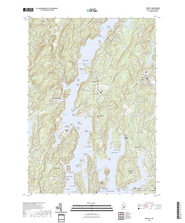
2024 Map of Bristol
USGS Topo · Published 2024About this map
The winding shoreline of the Pemaquid River and its numerous coastal coves define this coastal Maine landscape. The settlement patterns of Bristol, Pemaquid, and New Harbor reflect the long-standing maritime and agricultural heritage of Lincoln County. Small family-named landmarks like Herbert Yard and several scattered burial sites, including the Stephen Bryer Farm Cem and McFarland-Erskine Family Cem, provide specific points of interest for genealogical research and local history.
Find a feature on this map
183 named features on this map. Tap any name to fly to it.
Don’t see what you’re looking for? This feature index may not catch every label — zoom into the map to look around manually.
Map Details
Editions of this 2024 Bristol Map
This is the sole edition of this map. No revisions or reprints were ever made.
Other maps of this area

1893 · Wiscasset
USGS Topo · 1:62,500

1893 · Boothbay
USGS Topo · 1:62,500

1904 · Monhegan
USGS Topo · 1:62,500

1906 · Monhegan
USGS Topo · 1:62,500

1913 · Waldoboro
USGS Topo · 1:48,000

1915 · Waldoboro
USGS Topo · 1:62,500

1941 · Waldoboro
USGS Topo · 1:62,500

1941 · Boothbay
USGS Topo · 1:62,500

1943 · Boothbay
USGS Topo · 1:62,500

1944 · Wiscasset
USGS Topo · 1:62,500