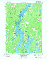
1969 Map of Bristol
USGS Topo · Published 1974About this map
The Damariscotta River and Johns River dominate this coastal landscape, defining a network of islands, necks, and coves that shaped the settlement of Lincoln County. The map documents significant historical sites including the Old Walpole Meetinghouse near Walpole and the Harrington Meetinghouse further east. These structures, alongside the presence of several Cem locations and the West Bristol Cem, provide a detailed view of the community's ancestral footprint.
Find a feature on this map
76 named features on this map. Tap any name to fly to it.
Don’t see what you’re looking for? This feature index may not catch every label — zoom into the map to look around manually.
Map Details
Editions of this 1969 Bristol Map
This is the sole edition of this map. No revisions or reprints were ever made.
Other maps of this area

1893 · Wiscasset
USGS Topo · 1:62,500

1893 · Boothbay
USGS Topo · 1:62,500

1904 · Monhegan
USGS Topo · 1:62,500

1906 · Monhegan
USGS Topo · 1:62,500

1913 · Waldoboro
USGS Topo · 1:48,000

1915 · Waldoboro
USGS Topo · 1:62,500

1941 · Waldoboro
USGS Topo · 1:62,500

1941 · Boothbay
USGS Topo · 1:62,500

1943 · Boothbay
USGS Topo · 1:62,500

1944 · Wiscasset
USGS Topo · 1:62,500