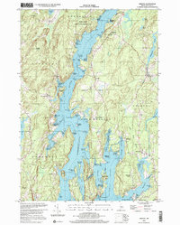
2000 Map of Bristol
USGS Topo · Published 2001About this map
Coastal Lincoln County’s intricate peninsula geography is defined by the Damariscotta River and the Johns River as they flow toward the Atlantic. This survey captures a landscape where historical meetinghouses, including the Old Walpole Meetinghouse and Harrington Meetinghouse, serve as enduring landmarks for local genealogists and historians. The maritime character of the region is evident in the numerous coves and points, such as Dodge Point, Seal Cove, and Pemaquid Harbor, which have long supported the local fishing and seafaring economies.
Find a feature on this map
81 named features on this map. Tap any name to fly to it.
Don’t see what you’re looking for? This feature index may not catch every label — zoom into the map to look around manually.
Map Details
Editions of this 2000 Bristol Map
This is the sole edition of this map. No revisions or reprints were ever made.
Other maps of this area

1893 · Wiscasset
USGS Topo · 1:62,500

1893 · Boothbay
USGS Topo · 1:62,500

1904 · Monhegan
USGS Topo · 1:62,500

1906 · Monhegan
USGS Topo · 1:62,500

1913 · Waldoboro
USGS Topo · 1:48,000

1915 · Waldoboro
USGS Topo · 1:62,500

1941 · Waldoboro
USGS Topo · 1:62,500

1941 · Boothbay
USGS Topo · 1:62,500

1943 · Boothbay
USGS Topo · 1:62,500

1944 · Wiscasset
USGS Topo · 1:62,500