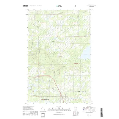
2019 Map of Britt
USGS Topo · Published 2019About this map
Superior National Forest encompasses a significant portion of this landscape, where the iron-rich geology of the Mesabi Range meets the water-heavy terrain of Saint Louis County. The small community of Britt sits at a junction of regional roads, while the northern extent of Mountain Iron enters the frame from the south. The map documents a complex network of forestry and industrial roads, notably the extensive system of spurs including Big Aspen Spur and the Taconite road, which highlight the region's historical and ongoing ties to timber and mining extraction.
Find a feature on this map
60 named features on this map. Tap any name to fly to it.
Don’t see what you’re looking for? This feature index may not catch every label — zoom into the map to look around manually.
Map Details
Editions of this 2019 Britt Map
This is the sole edition of this map. No revisions or reprints were ever made.
Other maps of this area

1950 · Mc Kinley
USGS Topo · 1:24,000

1950 · Biwabik NW
USGS Topo · 1:24,000

1951 · Mc Kinley
USGS Topo · 1:24,000

1951 · Biwabik NW
USGS Topo · 1:24,000

1951 · Virginia
USGS Topo · 1:24,000

1951 · Kinney
USGS Topo · 1:24,000

1951 · Britt
USGS Topo · 1:24,000

1952 · Idington
USGS Topo · 1:24,000

1954 · Hibbing
USGS Topo · 1:250,000

1956 · Lost Lake
USGS Topo · 1:24,000