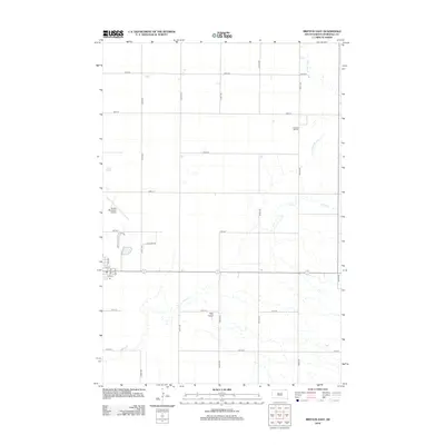
2012 Map of Britton East
USGS Topo · Published 2012About this map
Agricultural grid lines and natural drainage patterns define this area of Marshall County just east of Britton. The landscape is characterized by the meandering path of Wild Rice Cr and the marshy expanse of Gronseth Slough to the north, while Crow Cr winds through the central and southern sections. These waterways are interspersed with a strictly organized section-line road system, including 105th St through 112th St. Cultural landmarks are concentrated on the western edge, where the Britton Municipal Airport serves the local community. Further north, the Pleasant Hill Cem sits along 428th Ave, providing a genealogical point of interest for the region. The map also captures the distinct terrain of Oak Gulch, illustrating the subtle elevation changes in this prairie environment.
Find a feature on this map
25 named features on this map. Tap any name to fly to it.
Don’t see what you’re looking for? This feature index may not catch every label — zoom into the map to look around manually.
Map Details
Editions of this 2012 Britton East Map
This is the sole edition of this map. No revisions or reprints were ever made.
Other maps of this area

1953 · Britton East
USGS Topo · 1:24,000

1953 · Kidder
USGS Topo · 1:24,000

1953 · Newark
USGS Topo · 1:24,000

1953 · Milbank
USGS Topo · 1:250,000

1954 · Kidder SE
USGS Topo · 1:24,000

1956 · Havana
USGS Topo · 1:24,000

1956 · Britton West
USGS Topo · 1:24,000

1958 · Milbank
USGS Topo · 1:250,000

1958 · Spain
USGS Topo · 1:24,000

1958 · Britton 4 NW
USGS Topo · 1:24,000